
Choose a full coastal outing or a shorter section between Bondi, Tamarama, Bronte and Coogee, accounting for closures, steps and your return journey.
Bondi to Coogee is best planned as a one-way coastal outing with optional stopping points, rather than a compulsory there-and-back walk. The familiar route is about 6 km, but stairs, photographs, beach stops and current diversions matter more than that headline distance. Choose your intended finish and return transport before starting.
Access check, 21 October 2026: Waverley Council says parts of North Bronte beach and the coastal walk toward the surf club remain closed following rockfall. Do not assume an uninterrupted shoreline route. Follow current signed diversions; if an open onward connection is unclear, shorten the walk or take transport to another starting point. The council's remediation update does not provide a confirmed reopening date.
Choose the version that fits your day
| Plan | Best reason to choose it | Main consideration |
|---|---|---|
| Bondi promenade and a short outward walk | Ocean scenery with easy control over distance | Turn back before the walk exceeds your group's comfort |
| Bondi to Tamarama | Headland scenery; Sculpture by the Sea during its dates | Steps, exposed sections and event crowds |
| Bondi toward Bronte | A longer northern outing with a planned beach-area finish | North Bronte closures affect the approach |
| Clovelly to Coogee via Gordons Bay | Southern coastal scenery without crossing North Bronte | Gordons Bay has steps; this is not a continuous accessible route |
| Full Bondi to Coogee | A walk is the main activity of the day | Confirm current connections and allow for diversions |
| Reverse, Coogee to Bondi | Finish with the beach or a meal at Bondi | Same access checks and stairs apply |
Allow half a day for the full outing including travel and pauses as an editorial estimate, and longer if swimming or a substantial meal is central. A 2–3-hour walking allowance is only a baseline in ordinary conditions, not a promise during closures or the sculpture exhibition. Our Sydney experiences guide helps compare this commitment with a harbour or museum day.
Start with the northern section if Bondi is the priority
Begin on Bondi's beachfront promenade, then approach the coastal path at the southern end near Bondi Icebergs. You can enjoy the beach setting before deciding how far to continue. Bondi Junction is a transport interchange inland, not the beach itself, so include the onward journey when estimating your arrival.
The route toward Tamarama passes headland scenery around Marks Park. Think of this as a complete shorter outing if the main purpose is ocean views and photographs. Reaching Coogee does not make the earlier landscape better; it simply adds more coast and more walking.
The council's Hello Bondi walking page gives a useful sense of the northern distances: the Bondi promenade is about 1 km, while South Bondi to North Bronte is about 1.5 km. Those measurements refer to specific sections and should not be added blindly to a generic full-route distance with different start points. The current Bronte closure also changes what you can actually walk.
If you only want a manageable outing, set Tamarama as a decision point. Stop, assess the group and either continue on permitted paths, return to Bondi or leave by the transport option you checked beforehand. Do not defer that decision until someone is exhausted.
Treat Bronte as an access check, not an assumed through-route
North Bronte's closure is a practical constraint, not a reason to follow other walkers around a fence. The council describes damage to the cliff, beach access stairs and drainage infrastructure, with ongoing rockfall risk. The affected coastal section toward the surf club is to remain closed until remediation and stabilisation are complete.
Use signs and current council advice for any diversion. Use only a currently signed diversion; do not assume a particular staircase is open. A map showing a line beside the water can outlast the conditions that made that line usable. Allow extra distance and climbing if an authorised alternative uses surrounding streets.
When a continuous route is uncertain, choose one side deliberately. You can enjoy Bondi and Tamarama as the northern outing, or travel directly to Clovelly for the southern section toward Coogee. That avoids turning your day into an improvised search around a damaged cliff.
A Bronte-area meal or beach stop can still be a destination if you verify its own approach. Reaching the neighbourhood by road and walking through the closed coastal section are different questions. Keep the purpose of the visit clear and do not make a specific shore path indispensable.
Continue south only when the connection works
On the usual coastal sequence south of Bronte, the route passes the Waverley Cemetery area before Clovelly, then Gordons Bay and Coogee. Treat this as orientation, not a claim that every part is open on your walking day. Follow official wayfinding and remain on public paths.
Randwick Council's coastal walkway guide describes the southern connection through Clovelly, Gordons Bay and Coogee. It specifically excludes Gordons Bay from the wheelchair- and pram-friendly description of that wider section. A pleasant waterfront at one beach does not establish an accessible route to the next.
Clovelly is a useful place to decide whether to continue toward Coogee or finish earlier. Check the remaining path and your return option while you still have energy. Around Gordons Bay, focus on the coastal landscape rather than assuming that a small bay is an easy or supervised swimming stop.
At Coogee, stop the walking itinerary before adding another attraction or a further southern extension. Find somewhere to sit, decide whether you want food, and check live departures. The full coast offers more than one day's attention; you do not need to extend the route simply because another path continues.
Stairs and access change the right choice
The full walk is not continuously step-free. Destination NSW's route summary describes the approximately 6 km route, including steep sections of stairs, and does not recommend the full route for prams or wheelchair users. Do not treat a paved surface as proof of easy access.
For a wheelchair, stroller or limited walking tolerance, choose a particular promenade, park or viewing area and check the whole approach. Hello Bondi identifies accessible viewing options around Marks Park and level sections near the beaches, but these do not connect into a fully accessible Bondi–Coogee itinerary. Ask about gradients, kerbs, toilets and transport for your selected stop.
With children, a shorter outing can be the stronger plan even when the adults could complete the distance. Keep food and shade breaks before fatigue becomes the only decision-maker. Our Sydney family guide helps balance coastal walking with the other days of the trip.
Sculpture by the Sea changes the northern walk
The organiser's 2026 event guide confirms 16 October–2 November 2026 for Sculpture by the Sea at Bondi. The exhibition occupies the Bondi–Tamarama coastal area, so it can be the main purpose of a short northern visit rather than an extra squeezed into a fast walk to Coogee.
Give the sculptures time if they are why you came. Crowds gather at artworks and viewpoints, changing the pace of the narrow path. Move aside before stopping for photographs and follow event staff instructions. Completing the full coastal route and appreciating an outdoor exhibition are separate ambitions; combine them only with a generous day.
Transport for NSW's event advice recommends public transport, warns of queues and traffic, and lists temporary arrangements. It also flags rail works on 24–25 October 2026 affecting the City Circle and the Central–Wynyard corridor, while stating that trains continue between the city and Bondi Junction. Check your complete trip for the date, not just the final bus to the beach. Outside the exhibition dates, use ordinary service information rather than assuming event buses continue.
Prepare for the coast and separate swimming from walking
Bring water, sun protection and shoes suitable for stairs and uneven or wet patches. The coastal path is exposed even when nearby parks offer shade. Check the forecast and warnings before leaving; reduce or postpone the headland sections when wind, storms or heat would make them unsuitable for your group.
A beach can be a place to rest without entering the ocean. If swimming is part of the plan, use the current patrol information, flags and lifeguard advice at that specific beach. Waverley Council's beach guidance advises swimming during patrol hours and between the red-and-yellow flags. A calm-looking photograph or sheltered shape does not establish conditions on the day.
Do not climb onto exposed rocks to get a view around a barrier, and keep children away from cliff edges. Ocean pools are separate facilities whose availability depends on their own conditions and schedules. You can have a satisfying coastal outing without swimming at every stop.
Choose transport for the endpoint you actually use
Use the Transport for NSW trip planner for the date and time you expect to travel. Plan the outward leg to Bondi Beach or your alternative start, then a separate return from Coogee, Clovelly, Bronte or Tamarama as appropriate. Verify the actual stop and any walk uphill to reach it.
Avoid leaving a car at the start unless you have consciously accepted the return journey to collect it. Public transport makes a one-way walk easier to shorten and avoids relying on scarce beach parking, especially during the exhibition. Save an early-exit option before setting off rather than assuming a bus will be waiting directly beside every section of path.
Choose one intended finish, one earlier stopping point and enough time to change your mind. The worthwhile part is spending time beside the ocean; the distance on the map should serve that purpose.
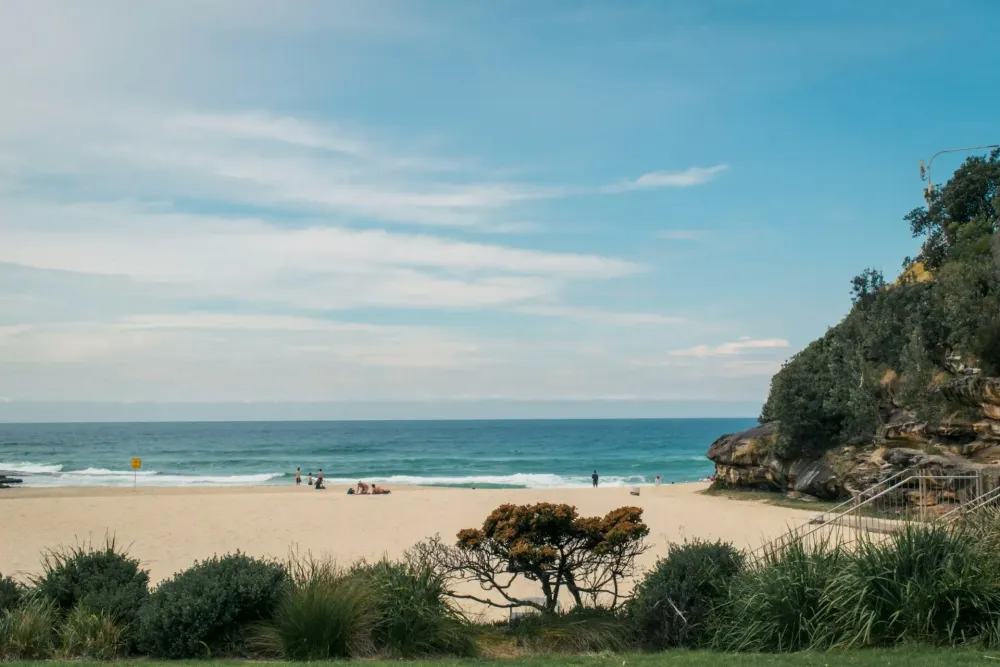
Cover photograph: Tamarama Beach and coastal steps on the Bondi to Coogee route. Photo: April Pethybridge / Unsplash. Source · License.
Frequently Asked Questions
How long is the Bondi to Coogee walk?
The familiar full route is about 6 km one way. Allow 2–3 hours as an ordinary walking baseline, with more time for travel, pauses, diversions and event crowds. Half a day is an editorial outing estimate.
Is the entire coastal route open?
On 21 October 2026, Waverley Council still reports closures at North Bronte affecting parts of the beach and coastal walk toward the surf club. Check current signs and council updates; do not assume uninterrupted access.
Can I take a wheelchair or pram along the whole walk?
The full route is not continuously accessible and includes stairs. Choose a specific accessible promenade or viewing area and verify its approach; Gordons Bay interrupts the accessible description of the southern section.
When is Sculpture by the Sea in 2026?
The Bondi event runs 16 October–2 November 2026 along the Bondi–Tamarama area. Allow extra time for crowds and check event transport arrangements for your date.
Do I have to swim or walk all the way to Coogee?
No. A shorter section is a complete outing, and the coast can be enjoyed from the path. Decide about swimming separately using local flags, patrols and conditions.

Keep Exploring

Brooklyn Bridge and DUMBO: Plan Your Walk
Cross toward the skyline or finish beside the river: choose your Brooklyn Bridge entrance, DUMBO stops and return journey before setting out.

High Line and Chelsea: Plan Your Walk
Walk a focused section of the High Line, finish at Chelsea Market and decide whether to add the Whitney. Includes access checks and clear free-versus-paid distinctions.

Singapore Botanic Gardens: Plan Your Visit
Choose your entrance, orchid visit or family route at Singapore Botanic Gardens, with current access rules and practical ways to plan a shorter outing.